Austin Bergstrom International Airport (AUS)
Orientation and Maps
(Austin, Texas (TX), USA)
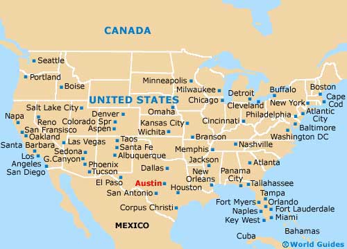
Situated in south-central Texas, Austin lies directly south of Dallas and Fort Worth, being connected to both by the busy I-35 freeway. Also nearby, San Antonio is located to the south of Austin, while Houston is sited to the east.
Off the Highway 71 and on the southwestern side of the city, Austin Bergstrom International Airport (AUS) is one of the largest airports in Texas. Within the city itself, the bus station for Greyhound and Kerrville buses is located on the northern side of downtown Austin, along East Koenig Lane, while the Capital Metro bus station operates regular city buses from East 8th Street. The Amtrak train station sits on North Lamar Boulevard and is served by a range of trains, including both Sunset Limited and Texas Eagle trains.
Austin Bergstrom International Airport (AUS) Maps: Important City Districts
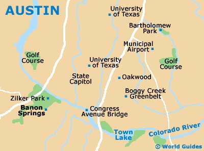
One of the main arteries in the centre of Austin is Guadalupe Street, which heads in a westerly direction and runs parallel to the Congress Avenue. The University of Texas (UT) campus is situated in the city center, with the Hyde Park area being located directly north.
Some of the best shopping in Austin can be found where West 6th Street joins Lamar Boulevard. Nearby and around the East 6th Street area, the Warehouse District contains many of the city's best restaurants and nightclubs.
One of the main landmarks in Austin is the Town Lake, which is actually a part of the Colorado River that was dammed many years ago. This point marks the very south of the downtown district and is close to both Zilker Park and a lively part of the South Congress Avenue.
USA Map
Texas Map

Austin Map